
Where is Bali, INDONESIA?
 GPS
GPS
INDONESIABali
Longitude : 116° 22' 12.00''
Latitude : -8° -45' 0.00''
When to go?
Bali - INDONESIA
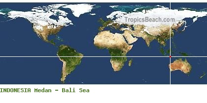
Bali is a city from INDONESIA. The white intersection on the left side map, shows its exact position in the world. You can use the GPS coordinates: latitude -8.75 and longitude 116.37 to find all the beaches by the Bali Sea with GoogleEarth or GoogleMaps.
Useful information about your trip to Bali
 Jet Lag is GMT+7, Local time : July 2026, Wednesday 22, 02:45 PM
  Take-off New York and Landing Denpasar-Ngurah Rai International Airport, Flight duration 19H20 (New York - Bali)
 Map of hotels and accommodations around Bali
Flight time from New York to Bali (INDONESIA) - Flight duration 19H20
As an indication, departures from New York to Bali are mainly at the two airports of New York. Flights from major cities in the USA are often possible. In all the best cases, the minimum flight time is 19H20 to cover a distance of 10.152 miles.
Landing and take-off : Denpasar-Ngurah Rai International Airport. Flight time New York - Bali : 19H20 More information about this destination ...
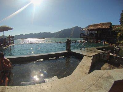 BALI LAKE DANAU BATUR
 NUSA DUA BEACH - BALI