
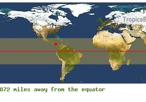
Where is San Andres, COLOMBIA?
 GPS
GPS
COLOMBIASan Andres
Longitude : -81° -42' -26.51''
Latitude : 12° 32' 34.68''
When to go?
San Andres - COLOMBIA
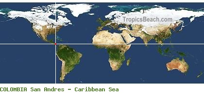
San Andres is a city from COLOMBIA. The white intersection on the left side map, shows its exact position in the world. You can use the GPS coordinates: latitude 12.542968 and longitude -81.707365 to find all the beaches by the Caribbean Sea with GoogleEarth or GoogleMaps.
Useful information about your trip to San Andres
 Jet Lag is GMT-5, Local time : July 2026, Sunday 26, 06:04 PM
  Take-off New York and Landing Gustavo Rojas Pinilla International Airport, Flight duration 04H30 (New York - San Andres)
 Map of hotels and accommodations around San Andres
Flight time from New York to San Andres (COLOMBIA) - Flight duration 04H30
As an indication, departures from New York to San Andres are mainly at the two airports of New York. Flights from major cities in the USA are often possible. In all the best cases, the minimum flight time is 04H30 to cover a distance of 2.001 miles.
Landing and take-off : Gustavo Rojas Pinilla International Airport. Flight time New York - San Andres : 04H30 More information about this destination ...
 TAYRONA
 SAN ANDRES